What shapes a site plan in metro Houston
Metro Houston pairs a central city with no use zoning and surrounding counties that regulate land through engineering rules. Five conditions follow, and each one changes how a preliminary site plan is drawn and reviewed here.
- The plat is the entitlement. Houston requires a development plat for new construction or an exterior enlargement, both inside the city and in its extraterritorial jurisdiction (ETJ), under Code Sec. 42-22 [1]. Chapter 42 reaches the ETJ through Secs. 42-20 and 42-22, so land outside the city limits can still answer to the city's platting rules [7].
- Floor elevations are set from the 500-year line. Chapter 19, in force since Sept. 1, 2018, places a new structure in the 100-year or 500-year floodplain at 2 feet above the 500-year elevation, and a critical facility or a floodway structure at 3 feet above it [2]. Houston Public Works counts 31% of the city inside the 100-year floodplain [3].
- The counties around the city are unzoned. Waller County adopted its Subdivision and Development Regulations "acting pursuant to Chapter 232, Texas Local Government Code" [5], and Montgomery County's Permit Department states that the county "does not have zoning regulations, and does not issue Certificates of Occupancy for buildings or structures" [8]. On both sides of the city, drainage, floodplain, fire and access rules set the layout in place of a use table.
- Growth is the fastest in the country. The Houston metro added 126,720 residents from July 2024 to July 2025, first among US metros, and reached 7,904,627 on July 1, 2025 [4].
- State law reaches its commercial land. A law firm summary lists Houston, Pasadena and Sugar Land among the cities where SB 840 allows multifamily housing by right on land zoned for commercial uses [9].
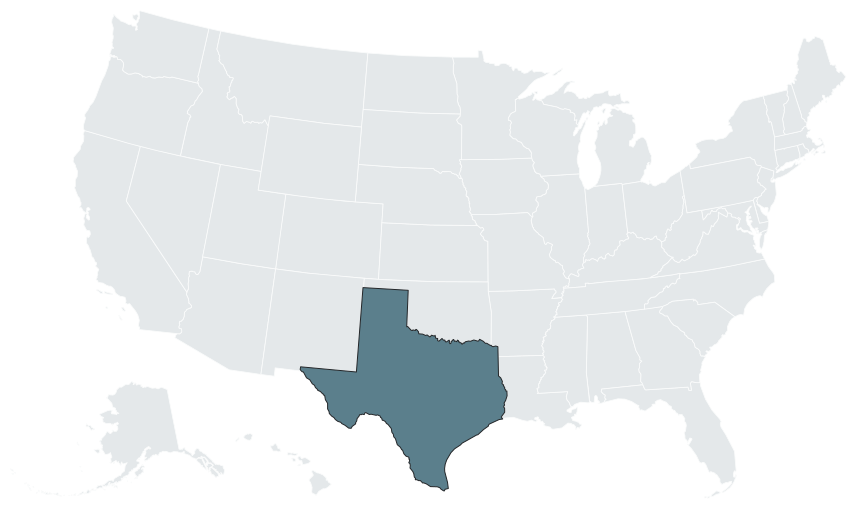

Jurisdiction map: who governs where
Which side of a city limit, an ETJ line or a drainage district boundary a parcel sits on decides which rulebook its site plan answers to.
| Jurisdiction | Governs | What a developer needs to know |
|---|---|---|
| City of Houston | The city and its ETJ | Development plats under Chapter 42; the Planning Commission acts on development plats under Sec. 42-75 [7, 10] |
| Unincorporated Waller County | The I-10 corridor west of the city, between Katy and Sealy | No zoning; the county controls a project through platting, drainage, floodplain permits and its fire code [5] |
| Brookshire ETJ | City extraterritorial land along I-10 in Waller County | The plat carries the city's approval (Sec. 3.4.22) and follows interlocal procedures (Sec. 3.3.6) [5] |
| Brookshire-Katy Drainage District | District land near Brookshire | Written district approval of the development plans is a condition of final plat (Sec. 3.5.2) [5] |
| Unincorporated Montgomery County | North of the city, around Lake Conroe | No zoning and no certificates of occupancy; a Development Permit for each structure [8, 6] |
| City of Conroe | Land inside Conroe | No zoning ordinance; a Commercial Development Plan Permit from city Engineering [11, 12] |
| City of Montgomery | Land inside the city | Zoned; a rezoning or special use permit goes through the Planning and Zoning Commission and City Council [13] |
| TxDOT Houston District | Access to state highways across the metro | Driveway access permits filed through an online system, with traffic studies scaled by district guidelines [14, 15] |
Rules for unincorporated Harris County and for suburban cities such as Katy, Sugar Land, Pearland and League City are confirmed directly with each jurisdiction before a layout is fixed. The Dallas-Fort Worth, Austin and San Antonio pages cover the other Texas metros, and site plans in Texas sets out the statewide rules, from county powers to seal thresholds.
Site plan process: Houston's development plat
The Houston Permitting Center describes the development plat as a site plan approved under Sec. 42-22, so in this city the plat review is the site plan review [1].
| Step | Rule | Source |
|---|---|---|
| Instrument | Development plat, a site plan approved under Sec. 42-22 | [1] |
| Reach | The city and its ETJ (Secs. 42-20 and 42-22) | [7] |
| Submittal | A detailed site plan in 2 copies, under the Permitting Center's Approval of a development plat (PDD1003) | [1] |
| Submittal requirements | Sec. 42-46 | [16] |
| Plat classes | Class I, II and III (Sec. 42-23) | [17] |
| Decision | The director or the Planning Commission, as applicable | [7] |
| Variances | Decided by the Planning Commission (Sec. 42-81) | [7] |
| Work exempt from the plat | Parking lot or expansion; retaining wall or fence under 8 feet; detached single-family home on a recorded lot; temporary school classroom (Sec. 42-22) | [7] |
Chapter 42 also writes building lines that move a footprint. Under Secs. 42-150, 42-153 and 42-154, as read on a secondary mirror of the code, a retail center on a major thoroughfare whose right-of-way is 80 feet or less may qualify for a 5 foot or zero building line [18]. Where an unrestricted reserve is proposed for multifamily, the Planning and Development Department's plat notes of October 23, 2024 apply a parks and open space fee per unit under Sec. 42-251 [19]. The city's platting requirements are also set out in Chapter 4 of its Design Manual [17].
Site plan process: Waller County on I-10
Waller County's Subdivision and Development Regulations, effective March 15, 2021 and amended December 6, 2023, route a commercial site through the County Engineer and, for a final plat, the Commissioners Court [5].
| Step | Body | Rule | Source |
|---|---|---|---|
| Pre-application meeting | County Engineer | Secs. 3.1 and 3.3.3; no fee published | [5] |
| 911 address | Addressing coordinator | Issued before any permit; no address for any development until plat compliance is confirmed (Sec. 9.1) | [20, 5] |
| Plat or exemption | County Engineer | A plat when a tract is divided into two or more parts with any part of 10 acres or less (Sec. 2.22); otherwise an exemption (Sec. 13.2) | [5] |
| Preliminary plat | County Engineer; the Court may overrule | $500 for 5 or fewer parcels, $3,000 for a preliminary of 50 or fewer lots; lapses without a final plat within 1 year (Sec. 3.5.8) | [21, 5] |
| Drainage plan and Drainage Impact Analysis | County Engineer | Prepared and sealed by a Texas PE (App. E Sec. II) | [5] |
| Commercial civil design plans | County Engineer | $3,000 plus $50 per acre over 2 acres; Texas PE (App. A Sec. 1) | [21, 5] |
| Final plat | Commissioners Court | $1,000, or $500 for 5 or fewer parcels; PE certification (Sec. 3.6.13) and RPLS seal | [21, 5] |
| Development permit, project over $10M | County floodplain administrator | $3,000 plus $500 inspection outside the flood zone; $10,000 plus $1,000 inspection plus $0.10 per SF inside it; fees double if work starts before the permit | [21, 22] |
| Fire code permit | County Fire Marshal | Stamped plans with a full site plan of fire lanes and hydrants | [23] |
Two overlays change the path on the corridor. Inside Brookshire's ETJ, the plat must carry "Approval of the appropriate jurisdiction when the subdivision is within the extraterritorial jurisdiction (ETJ) of that city" (Sec. 3.4.22), and a variance affecting the ETJ goes through the city under Local Government Code 242.001 (Sec. 8.3) [5]. Inside the Brookshire-Katy Drainage District, the developer obtains the district's written approval of the development plans before final plat (Sec. 3.5.2), and where county and district criteria differ, the more stringent of the two applies [5]. The truck stop model project in Waller County follows this path step by step for a travel center.
Site plan process: Montgomery County, Conroe and the City of Montgomery
North of the city, three rulebooks meet around Lake Conroe.
Montgomery County. The county's commercial permit packet sets the pace of a multi-building site: "Every Commercial Structure (open or enclosed) and/or addition (open or enclosed) requires its own permit," each at $150 plus $0.015 per sq ft, and "Development permits expire 180 days from the date they are entered into our permitting system, regardless of their review status" [6]. A drainage plan goes to County Engineering once covered area on the whole property, building footprint and paving included, exceeds 15,000 sq ft [6], and grading, paving and detention take a separate Non-Structure Development Permit at $200 [24]. The county's Fire Code permitting page adds that 10 Development Structure Packets submitted on one day need only one Fire Code application, while a submittal the next day starts a new Fire Code review [25]. Occupancy follows the Fire Marshal's Certificate of Compliance, because the county issues no certificates of occupancy [8].
City of Conroe. Conroe states that "The City of Conroe does not have a Zoning Ordinance," and a Letter of No Zoning is available from the City Planner [11]. City Engineering has required a pre-development meeting since September 12, 2024 [26], and its Commercial Development Plan Permit checklist of May 28, 2025 asks for sealed engineer's sheets at 24 x 36 inches, parking stalls of at least 20 ft by 9 ft, driveways of 25 to 45 ft, a 6 ft opaque fence or equivalent planting next to existing residential, detention on any tract of 1 acre or more, and finished floors 1 ft above the adjacent 100-year water surface elevation [12].
City of Montgomery. The city's Development Handbook, revised August 2025, starts a project with a pre-development meeting and a feasibility study funded by an escrow of at least $5,000; a rezoning or special use permit then takes 2 Planning and Zoning Commission hearings and 1 City Council hearing, at $500 plus time and materials for the zoning item [13]. Under Local Government Code 211.006, a protest signed by the owners of 20% or more means the change takes a three-fourths Council vote, and a denied request may not be refiled for 6 months [13].
The RV and boat storage model project in Montgomery County works through the county's per-structure permits for a canopy program.
TxDOT Houston District access
Most commercial sites on the metro's highways meet the TxDOT Houston District before they meet a county or city. Driveway access permits are filed in the district's online DAP system [14]. The district's Traffic Study Guidelines set two levels, a minor study for 50 to 150 peak-hour trips and a major study at 150 or more peak-hour trips or 1,500 or more daily trips [15], and its DAP checklist treats a driveway serving more than 20 vehicles per day as commercial [27]. A traffic impact analysis is signed, sealed and dated by a Texas-licensed engineer [28]. On frontage roads at 50 mph or more, connections are spaced at least 425 ft apart one-way and 510 ft two-way [29], and the Roadway Design Manual asks for at least 250 ft of separation from an exit ramp to the downstream driveway or side street (Sec. 8.1.21) [30].
Asset rules in metro Houston
The rules that bind each asset here are city parking and platting rules, county engineering rules or lake licensing, depending on where the parcel sits.
| Asset | Rule that applies in metro Houston | Source |
|---|---|---|
| Car washes, City of Houston | Sec. 26-492, Class 9: 2.5 spaces per automated bay or stall; 1.0 per bay for other washes | [31] |
| Multifamily, City of Houston | Parks and open space fee per unit on unrestricted reserves proposed for multifamily (Sec. 42-251); SB 840 by right on commercial land, with Houston, Pasadena and Sugar Land on a law firm's list of covered cities | [19, 9] |
| Truck stops and travel centers, Waller County | Unzoned; 25 ft front building line and side street lines of 15, 25 and 35 ft by street class (Sec. 3.4.15); 200 ft between driveways on arterials without curb (App. A 11.1); a 25 ft pipeline setback where no easement is defined (Sec. 3.6.2) | [5] |
| RV and boat storage, Montgomery County | One Development Permit per canopy or enclosed building; gravel and road base count as 100% impervious, with a runoff coefficient of 0.85, the same as asphalt (DCM Table 2-5) | [6, 32] |
| RV and boat storage, Conroe | Asphalt or concrete parking, 20 ft by 9 ft stalls and detention on tracts of 1 acre or more | [12] |
| Marinas and shoreline businesses, Lake Conroe | The San Jacinto River Authority licenses "commercial operations (marinas, boat/personal watercraft rentals, construction, and any other businesses on the reservoir)" | [33] |
State rules for these assets are on car wash site plans in Texas, gas station site plans in Texas and RV and boat storage site plans in Texas; layouts are on the truck stop, RV and boat storage, multifamily and marina hubs.
Growth corridors and proof points
The metro grew from a 2020 base of 7,150,227 residents to 7,904,627 on July 1, 2025, a gain of 754,400 or about 10.6%, and Harris County alone counted 5,045,026 [4]. Permits eased while the population climbed: the metro authorized 65,747 housing units in 2024 against 68,755 in 2023, and the City of Houston 11,898 against 16,430 [34].
West of the city, I-10 is a freight corridor. TxDOT's Brookshire-Pattison Mobility Study of March 3, 2025 finds that trucks are 24% of I-10 traffic there, against an 18% average on Texas interstates, and projects truck traffic growing from 14,000 in 2023 to 30,100 in 2045 [35]. Fuel retail keeps filing under the county regime: FuelMaxx 124 at 6810 FM 359 in Brookshire, an 8,490 SF c-store with a fueling canopy, registered with TDLR on June 12, 2025 at an estimated $1,273,500 [36], and the FM362 Retail Center at 7023 FM 362, a 7,200 SF c-store with a gasoline canopy and two driveways, registered on September 26, 2024 at $1,200,000 [37]. Commercial platting is routine on the corridor: the 2.289-acre Sunterra Corner Store final plat sat on the Commissioners Court consent agenda of May 1, 2024 [38], and a County Engineer memo of June 26, 2024 recommended approval of the 2.1618-acre Sunterra Commercial Development Sec 1, with frontage on Stockdick Road and its 100 ft right-of-way [39].
North of the city, TDLR registrations show RV and boat storage being built across Montgomery County: Foxgate Boat and RV Storage Phase 1 near Magnolia, 44,700 sf at an owner-reported estimate of $850,000, registered August 29, 2024 [40]; a Boat / RV Storage project at 17471 S. Tram Rd in Patton Village, 54,530 sf at an owner-reported estimate of $1,225,000, registered January 19, 2023 [41]; and Milstead Storage Buildings 1 and 2 at 700 McCaleb Rd in Montgomery, 54,000 sf of lease office, warehouse and boat and RV storage at an owner-reported estimate of $3.4M, registered May 25, 2022 [42]. A registration of this kind is a state accessibility filing, not a land use approval.
Utility capacity can stop site planning outright. As the Houston Chronicle reported in August 2024, Conroe's City Council approved a 120-day moratorium on new residential and commercial development on the city's north side [43]; the council extended it "once in December and again in April," then ended it after TCEQ lowered the required flow per connection from 0.6 to 0.46 gpm [44]. Market context is in the posts on Houston retail development and the Houston industrial market.
Site factors
- Waller County floodplain. Plats show the 100-year and 500-year boundaries (Secs. 3.4.5 and 3.6.3); structures in the 100-year floodplain are raised 2 feet or more above the 500-year elevation and those in the 500-year floodplain 1 foot above it, and no development permit issues in a Flood Hazard Area below base flood elevation (App. B Item 8) [5]. The county has required a CLOMR before structural fill in the 0.2% and 1% floodplains, and an industrial applicant sought a variance from that requirement on June 15, 2026 [45].
- Waller County detention. County policy is to "maintain zero net increase in storm water runoff rates" [5]. Detention storage may not fall below 0.55 ac-ft per acre, ponds take 4:1 slopes and 30 ft maintenance berms, and ponds over 2 acres carry 1 foot of freeboard [5]. Rainfall comes from NOAA Atlas 14, with a 100-year, 24-hour excess rainfall of 16.00 in. at Katy and 14.8 in. at Hempstead, commercial land takes a runoff coefficient of 0.90, and the coefficient method of sizing detention is not allowed once total developed commercial area will exceed 5 acres [5]. How detention shapes yield is covered in this post on stormwater as a site plan variable.
- Montgomery County drainage. The Drainage Criteria Manual, adopted August 26, 2025, allows no increase in flow leaving a project: post-project peak flow minus pre-project peak flow must be 0.00 cfs or less (Sec. 1.5) [32]. A long-term stormwater maintenance plan is recorded for a development area of 1 acre or more [6].
- Fire water. The Montgomery County Fire Marshal's guidelines form asks whether a hydrant sits within 400 ft of the property or whether NFPA 1142 on-site water, a tank or a dry hydrant, is provided [46].
- Truck routing. Waller County limits off-interstate truck routes through "No Thru Trucks" zones adopted after public hearing, such as Garvie Ln between FM 359 and FM 362 on April 15, 2026 [47].
What the preliminary plan carries in Houston
Because Houston's development plat is a site plan, the preliminary site plan is drawn as the sheet the city will read: building footprints and building lines, reserves, drives, parking, pads and yield, organized with a site data table. In Waller County, the regulations set no seal requirement in Section 3.1, the pre-application procedure, while drainage plans and reports and the final plat engineering certification carry a Texas PE's seal and the plat survey an RPLS seal [5]. In Montgomery County, the commercial Development Permit asks for a site plan or survey no larger than letter size paper and the packet states no seal for it, while the Drainage Criteria Manual requires the signature and seal of a Texas Licensed Professional Engineer on engineering drawings and drainage reports (Sec. 1.2) [6, 32]. Conroe's commercial site development plans are prepared by a Licensed Professional Engineer [48], and the TxDOT Houston District asks for a site plan of the entire development with driveway widths, radii and turning paths for the largest design vehicle [27].
Developers use the preliminary plan to choose the site, to have a general contractor price it, to show a lender and to raise capital; the engineer of record then adds grading, drainage, detention, utility and access design and prepares the sealed sets. The site plan consultant and site plan services pages explain how the studio works with the engineer and architect of record, where unsealed site plans are accepted covers the concept stage, the case studies show the method on model projects, and service areas lists every metro covered.
Frequently asked questions
Does Houston require a site plan?
It requires a development plat, which the Houston Permitting Center describes as a site plan approved under Sec. 42-22, for new construction or an exterior enlargement in the city and its ETJ [1].
Is a new parking lot exempt from Houston's development plat?
Yes. A parking lot or its expansion is exempt under Sec. 42-22(4) [7].
How high must a new building sit in Houston's floodplain?
Under Chapter 19, at 2 feet above the 500-year elevation in the 100-year or 500-year floodplain, and 3 feet above it for critical facilities and floodway structures [2].
Do I need a plat for a truck stop in unincorporated Waller County?
Only if the land is divided into two or more parts with any tract of 10 acres or less (Sec. 2.22); otherwise a plat exemption applies, and no 911 address issues until plat compliance is confirmed (Sec. 9.1) [5].
Does each storage canopy need its own permit in Montgomery County?
Yes. Each commercial structure, open or enclosed, takes its own Development Permit at $150 plus $0.015 per sq ft [6].
Does gravel reduce detention in Montgomery County?
No. Gravel and road base carry a runoff coefficient of 0.85 in the county's Drainage Criteria Manual (Table 2-5), the same as asphalt and concrete [32].
When does TxDOT's Houston District require a major traffic study?
At 150 or more peak-hour trips or 1,500 or more daily trips; a minor study covers 50 to 150 peak-hour trips [15].
Sources
- 1)Approval of a development plat (PDD1003), Houston Permitting Center. Accessed 2026-10-10.
- 2)Chapter 19 floodplain rules, effective Sept. 1, 2018 (summarized in Floodplain Rules and No Zoning, rawmags.com), City of Houston (secondary summary). Accessed 2026-10-10.
- 3)Chapter 19 Floodplain Ordinance Summary, Houston Public Works. Accessed 2026-10-10.
- 4)Slow Growth Impacts Nation's Largest Counties Hardest (CB26-56, Vintage 2025 estimates), U.S. Census Bureau. Accessed 2026-10-10.
- 5)Subdivision and Development Regulations (effective March 15, 2021, amended December 6, 2023), Waller County. Accessed 2026-10-09.
- 6)Development Permit Procedures, Commercial Structure packet (July 2, 2024), Montgomery County. Accessed 2026-10-09.
- 7)Code of Ordinances Chapter 42, Article II, Division 1, Platting Requirements (via Municode), City of Houston (text via Municode). Accessed 2026-10-10.
- 8)Codes, Zoning and Occupancy letter (revised November 2, 2015), Montgomery County Permit Department. Accessed 2026-10-09.
- 9)Texas Senate Bill 840: By-Right Multifamily Development Now in Effect, Haynes Boone. Accessed 2026-10-10.
- 10)Chapter 42, Subdivisions, Developments and Platting (ordinance redline), City of Houston Planning and Development Department. Accessed 2026-10-10.
- 11)Land Use and Area Plans, City of Conroe. Accessed 2026-10-10.
- 12)Application for a Commercial Development Plan Permit and checklist (May 28, 2025), City of Conroe Engineering. Accessed 2026-10-10.
- 13)Development Handbook (last revised August 2025), City of Montgomery. Accessed 2026-10-09.
- 14)Driveway Access Permit letter, August 21, 2023, TxDOT Houston District. Accessed 2026-10-10.
- 15)Traffic Study Guidelines, TxDOT Houston District. Accessed 2026-10-09.
- 16)Code of Ordinances Chapter 42, Article II, Sec. 42-46, development plat submittal requirements (via Municode), City of Houston (text via Municode). Accessed 2026-10-10.
- 17)Design Manual Chapter 4, Platting Requirements, City of Houston. Accessed 2026-10-10.
- 18)Code of Ordinances Sec. 42-150, building line requirement (via elaws), City of Houston (text via elaws). Accessed 2026-10-10.
- 19)Plat notes, October 23, 2024, City of Houston Planning and Development Department. Accessed 2026-10-10.
- 20)Engineering, Waller County. Accessed 2026-10-10.
- 21)Road and Bridge fee schedule (adopted July 24, 2024), Waller County. Accessed 2026-10-09.
- 22)Development Permit Application (revised November 8, 2024), Waller County. Accessed 2026-10-10.
- 23)Fire Marshal, Waller County. Accessed 2026-10-09.
- 24)Development Permit, Non-Structure application packet, Montgomery County. Accessed 2026-10-10.
- 25)Permitting, Fire Code Permits, Montgomery County. Accessed 2026-10-10.
- 26)Land Planning, City of Conroe Engineering. Accessed 2026-10-10.
- 27)Driveway Access Permit checklist, TxDOT Houston District. Accessed 2026-10-09.
- 28)Access Management Manual, Chapter 2, Section 2: Definitions, Texas Department of Transportation. Accessed 2026-10-10.
- 29)Access Management Manual, Chapter 2, Section 3: Number, Location, and Spacing of Access Connections, Texas Department of Transportation. Accessed 2026-10-09.
- 30)Roadway Design Manual 8.1.21, Access Control, Texas Department of Transportation. Accessed 2026-10-09.
- 31)Code of Ordinances Sec. 26-492, parking spaces for certain types of use classifications, City of Houston. Accessed 2026-10-10.
- 32)Drainage Criteria Manual (adopted August 26, 2025), Montgomery County. Accessed 2026-10-10.
- 33)Lake Conroe Licensing and Permitting, San Jacinto River Authority. Accessed 2026-10-09.
- 34)2024 Annual Building Permits highlights, U.S. Census Bureau. Accessed 2026-10-10.
- 35)Brookshire-Pattison Mobility Study, presentation and script (March 3, 2025), Texas Department of Transportation. Accessed 2026-10-09.
- 36)Project registration TABS2025021150, FuelMaxx 124, Brookshire, Texas Department of Licensing and Regulation. Accessed 2026-10-10.
- 37)Project registration TABS2025001887, FM362 Retail Center, Brookshire, Texas Department of Licensing and Regulation. Accessed 2026-10-10.
- 38)Commissioners Court meeting packet, May 1, 2024, Waller County. Accessed 2026-10-10.
- 39)County Engineer memorandum, Sunterra Commercial Development Sec 1 (June 26, 2024), Waller County. Accessed 2026-10-10.
- 40)Project registration TABS2024026586, Foxgate Boat and RV Storage Phase 1, Texas Department of Licensing and Regulation. Accessed 2026-10-10.
- 41)Project registration TABS2023009783, Boat / RV Storage, Patton Village, Texas Department of Licensing and Regulation. Accessed 2026-10-10.
- 42)Project registration TABS2022019994, Milstead Storage, Texas Department of Licensing and Regulation. Accessed 2026-10-10.
- 43)Conroe sets 120-day moratorium for new development over water supply issues, Houston Chronicle. Accessed 2026-10-09.
- 44)Development Can Resume In North Conroe As Customers' Water Supply Is Reduced, Bisnow. Accessed 2026-10-09.
- 45)Park 1489 CLOMR variance request letter (June 15, 2026), Waller County Commissioners Court agenda attachment. Accessed 2026-10-10.
- 46)Guidelines for Fire Code Permitting form, Montgomery County Fire Marshal's Office. Accessed 2026-10-10.
- 47)Commissioners Court meeting packet, April 15, 2026, Waller County. Accessed 2026-10-10.
- 48)Development Plans, City of Conroe Engineering. Accessed 2026-10-09.