What makes a Maryland site plan different
Maryland has no statewide site plan approval and no state land use permit. Site plan approval sits with the 23 counties, Baltimore City and the incorporated municipalities. What sets the state apart is how many state programs attach conditions to a plan before the local body can sign it. Five of them change the drawing itself.
1. A 1,000-foot overlay decides waterfront parcels
The Chesapeake and Atlantic Coastal Bays Critical Area covers land within 1,000 feet of tidal waters and tidal wetlands, under Natural Resources Article Title 8 Subtitle 18 and COMAR Title 27 [1, 8]. Land is classed as an Intensely Developed Area (IDA), Limited Development Area (LDA) or Resource Conservation Area (RCA), based on land uses existing on December 1, 1985 for the Chesapeake Bay Critical Area and June 1, 2002 for the Atlantic Coastal Bays [1]. The Critical Area measures lot coverage, not just impervious area: gravel, stone, shell, impermeable decking, pavers and permeable pavement all count [1]. The minimum buffer is 100 feet landward from mean high water, the landward edge of tidal wetlands or the top of bank of tributary streams, and it may be expanded to as much as 300 feet for contiguous sensitive areas, highly erodible soils or steep slopes [9].
Anne Arundel County states the working numbers: LDA and RCA development must hold impervious surface to between 15 and 31 percent of the site, a minimum 100 foot buffer applies, forest clearing is limited and replaced, and unforested developments must establish 15 percent of the site in forest [10]. IDA development is subject to the 10% Rule, a pollutant load reduction requirement [11]. A classification changes only through growth allocation, from a reserve equal to five percent of the jurisdiction's RCA land less federal property and tidal wetlands, and Habitat Protection Area requirements survive the change [8]. The county does not have the last word: in Smith v. County Commissioners of Kent County the Court of Appeals held that a county's growth allocation approval is not a final action subject to judicial review, because the Critical Area Commission may modify, reject, delay or preclude it [12]. On a waterfront parcel the lot coverage cap and the buffer, not the base zoning, usually set the yield.
2. Forest conservation reaches almost every commercial parcel
The Forest Conservation Act applies to any project of 40,000 square feet or more that requires a subdivision, grading or sediment control permit; those projects submit a Forest Stand Delineation and a Forest Conservation Plan for approval before proceeding [2]. 40,000 square feet is 0.92 acre, so very few commercial site plans fall below it. Under COMAR 08.19.03.01, "forest" means a biological community dominated by trees and other woody plants covering 10,000 square feet or more, and a tract with less than 15 percent of its net tract area in forest must be afforested up to at least 15 percent for specified land use categories [13]. That planting obligation comes out of the developable area, and it bites hardest on cleared farmland and vacant commercial pads. The Forest Preservation and Retention Act of 2023 (SB 526 / HB 723) revised the framework, and the Legislative Services analysis notes the holding in CBF v. CREG Westport Developers I that a forest conservation plan approval with a variance was a final decision appealable to the circuit court [14]. Local names differ: Frederick County calls its program the Forest Resource Ordinance, and Harford County administers it under Chapter 267 Article VI of its Zoning Code.
3. Stormwater is settled in the layout, not the pond
The Stormwater Management Act of 2007 (Environment Article §§4-201 to 4-215) and COMAR 26.17.02 require Environmental Site Design (ESD) to the maximum extent practicable, with structural practices only where absolutely necessary [15]. COMAR 26.17.02.02 defines that standard as exhausting all reasonable opportunities for ESD planning techniques and treatment practices [16]. COMAR 26.17.02.08 then requires every county and municipal ordinance to make the developer demonstrate ESD, including maintaining 100 percent of the average annual predevelopment groundwater recharge volume and limiting soil disturbance, mass grading and compaction [3]. Baltimore County describes the state-mandated sequence as three submissions, the concept, development and final stormwater plans [17]; it adds a 50 percent impervious reduction, or equivalent water quality management, for redevelopment, and issues no grading or building permit until the sediment control and stormwater plans are signed [18]. The engineer of record designs the ESD practices; the preliminary layout has to leave room for them from the first draft, which is why stormwater as a site plan variable matters more here than in most states.
4. Two counties approve site plans through a bi-county commission
In Montgomery and Prince George's counties the Maryland-National Capital Park and Planning Commission (M-NCPPC), not county government, holds site plan approval. In Montgomery the Planning Board approves the site plan after preliminary plan approval and before building permits issue, and the Planning Board hearing must occur within 120 days of intake acceptance [19]. Building permits issue from the Department of Permitting Services, which enforces the Certified Site Plan under a memorandum of understanding, with forest conservation excluded [20]. In Prince George's the Planning Board approves site plans, permits issue from the Department of Permitting, Inspections and Enforcement, and M-NCPPC checks permit plans for zoning conformance [21]. Montgomery adds a parallel utility clock: WSSC will not process the utility application until the applicant has submitted a Hydraulic Planning Analysis through WSSC's own ProjectDox review and cleared prescreen [22].
5. State highway access waits for local approval
A permit from MDOT SHA is required for any access onto a State highway, and SHA approves the location, design geometry, drainage requirements and paving cross section of the entrance [23]. SHA directs developers to begin local development approval before submitting anything to Access Management, with the local planning and zoning office forwarding the submittal to SHA; access submittals go to the District Engineer [24]. Local reviewers often want SHA's position before they sign, so the entrance has to be settled early, and the permit clock starts later than many schedules assume.
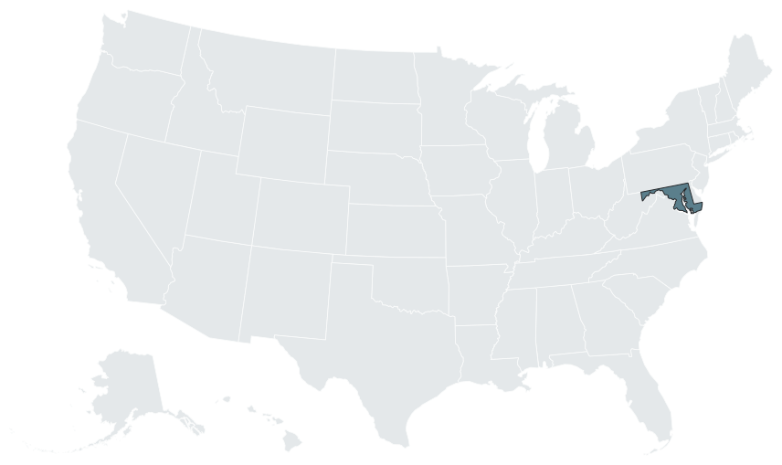

Approval layers: local, state and federal
| Layer | Body | What it decides | Source |
|---|---|---|---|
| Local | Planning board, planning commission, administrative law judge or department director | Zoning conformance, layout, landscaping, access, parking, adequate public facilities and the plan sequence | [19, 25, 26] |
| State | Maryland Department of the Environment | Stormwater, erosion and sediment control, wetlands and waterways, underground storage tanks | [15, 4, 27] |
| State | Department of Natural Resources | Critical Area Commission; Forest Service for forest conservation | [8, 2] |
| State | MDOT State Highway Administration | Access permits for entrances on State highways | [24] |
| State | Building Codes Administration, Maryland Department of Labor | Maryland Building Performance Standards, enforced locally | [28] |
| Federal | U.S. Army Corps of Engineers | Waters of the United States, routed through the Maryland State Programmatic General Permit and one Joint Federal/State Application to MDE | [27] |
The local sequence usually runs concept, preliminary, then final or site development plan [19, 29]. A mid-size commercial plan typically moves in this order:
- Concept and feasibility: zoning, Critical Area status, forest stand delineation scope and the ESD concept [1, 2, 3].
- Pre-application with the local planning office; Montgomery requires a pre-submission meeting for sketch plans [30].
- Forest Stand Delineation and Forest Conservation Plan approved before the project proceeds [2].
- Concept, development and final stormwater plans in sequence [17].
- The local filing, then a hearing or an administrative decision.
- Parallel reviews: the Joint Federal/State Application to MDE, SHA access through the local planning office, and WSSC in Montgomery [27, 24, 22].
- The 20-CP Notice of Intent, then the building permit from the county permitting agency [4].
For how the concept, preliminary and final stages differ, see preliminary vs final site plan.
Who prepares, seals and submits
All three design boards sit under the Maryland Department of Labor.
| Profession | Statute and rules | Sealing rule | Source |
|---|---|---|---|
| Architect | Business Occupations and Professions (BOP) Article Title 3; COMAR 09.21 | The architect who prepared or approved a final document required for a building permit signs, seals and dates it before issuing it (BOP §3-501). COMAR 09.21.02.03 allows sealing only with direct knowledge and responsible control during preparation | [31, 32, 33] |
| Professional engineer | BOP Title 14; COMAR 09.23 | COMAR 09.23.03.09 permits sealing documents required under BOP §14-403 only where the licensee is competent in the subject; an electrical PE is not qualified to seal the structural aspects of a project | [31] |
| Land surveyor | BOP Title 15; COMAR 09.13 | Two license classes, professional land surveyor and property line surveyor (BOP §15-101); no seal on documents not prepared under the licensee's responsible charge; business entities need a permit | [34, 35] |
COMAR 09.21.02.03 also lets a Maryland architect seal prototype standard drawings prepared by an out-of-State architect, where the Maryland licensee reviewed, adopted, coordinated and integrated them; that matters for national retail, quick-service and fuel rollouts [33]. At its October 2025 meeting the surveying board discussed fraud and the misuse of surveyor seals obtained through online platforms [35].
Local reviewers restate the rule. Howard County's Site Development Plan process requires a Maryland registered engineer or architect to prepare the plans and supplemental documents, including the forest stand delineation and conservation plan, wetlands analysis, floodplain study, noise study, sight distance analysis, storm drain and retaining wall computations and the adequate public facilities road test [36]. Worcester County's Technical Review Committee comments require a Maryland registered architect to seal plans [37].
A preliminary site plan is the layout those professionals build on: the disposition, buildings, drives, parking, pads and units, and the yield, organized with a site data table that tests coverage, setbacks and parking against the zoning and the Critical Area. The studio holds no seal. The client's engineer of record adds the ESD and stormwater design, the erosion and sediment control plan, the SWPPP, the SHA entrance design and the utility work; the qualified professional of record prepares the forest stand delineation and conservation plan; the surveyor supplies the boundary and topographic base. Who prepares a site plan sets out the split.
Statewide overlays
| Overlay | Trigger | Agency | Rule, timeline or fee |
|---|---|---|---|
| Building Performance Standards (COMAR 09.12.51) | Every jurisdiction | Building Codes Administration; local enforcement | 2021 I-codes effective May 29, 2023; local adoption by May 29, 2024 [7]. State adoption 18 months after a new edition, then 12 months for local amendment [38]. The Department of Labor lists each local amendment ordinance and contact [39]. Local amendments may not weaken the IECC, IBC Chapter 13, sprinkler or wind provisions [40] |
| Critical Area | Within 1,000 feet of tidal waters or tidal wetlands | Critical Area Commission and the local program | 100 foot minimum buffer, expandable to 300 feet; lot coverage includes permeable pavement [1, 9] |
| Forest Conservation Act | 40,000 square feet with subdivision, grading or a sediment control permit | Maryland Forest Service; local programs | Forest Stand Delineation and Forest Conservation Plan; afforestation to 15 percent [2, 13] |
| Environmental Site Design | Development requiring stormwater management | MDE through county and municipal ordinances | 100 percent of predevelopment recharge volume; limits on mass grading [3, 15] |
| Construction stormwater, 20-CP | One acre or more of disturbance | MDE | Effective April 1, 2023; Notice of Intent through MDE ePermits; 14-day public notice after the SWPPP and erosion and sediment control plan are in place [4, 5] |
| Wetlands, waterways and floodplain | Alteration of nontidal or tidal wetlands, waterways or the floodplain | MDE Regulatory Services Coordination Office | One Joint Federal/State Application, forwarded to MDE's divisions and the U.S. Army Corps of Engineers [41]; nontidal permits cover wetlands and a 25-foot buffer [42]; a Letter of Authorization is possible under 5,000 square feet of nontidal impact with no significant plant or wildlife value [43] |
| State highway access | Any entrance on a State highway | MDOT SHA District Engineer | Local approval first; the local office forwards the submittal [24] |
| Septic growth tiers | Residential subdivisions | Every county and municipality | Sustainable Growth and Agricultural Preservation Act of 2012; four tiers [6] |
Top jurisdictions: process, fees and timelines
| Jurisdiction | Site plan approval body | Process and timeline | Published rules and fees |
|---|---|---|---|
| Montgomery County | Montgomery County Planning Board (M-NCPPC) | Pre-preliminary, sketch or project plans, preliminary plans, site plans, record plats; hearing within 120 days of intake acceptance [19]; staff initial review of a sketch plan within 10 working days [30] | WSSC Hydraulic Planning Analysis runs in parallel and gates the utility approval [22] |
| Prince George's County | Prince George's County Planning Board (M-NCPPC); appeal to the District Council [44] | Zoning Ordinance, Subdivision Regulations and Landscape Manual effective April 1, 2022, after CR-136-2021 was adopted on November 29, 2021 [45] | A detailed site plan for infrastructure lets grading and infrastructure proceed before the architectural detail is complete [46] |
| Baltimore County | Administrative Law Judge at a quasi-judicial Development Plan Hearing; appeal to the Board of Appeals [25] | Pre-Concept Plan Conference, Concept Plan, Concept Plan Conference, Community Input Meeting, Development Plan, Development Plan Conference, Hearing [47]. Community Input Meeting held not less than 21 and not more than 30 days after the trigger; property posted 20 working days before the hearing [48] | No grading or building permit until sediment control and stormwater plans are signed [18] |
| Baltimore City | Planning Commission, with the Site Plan Review Committee and the Urban Design and Architecture Advisory Panel [49] | Final plan set to the UDAAP coordinator within 3 weeks of the final Design Development presentation; permit application within 18 months of final submission [50] | Traffic-Mitigation Zone projects of 15,000 square feet or more of gross floor area, or more than 50 dwelling units, contact the Department of Transportation [51]; preliminary meetings with plans examiners at $50 per half hour [52] |
| Anne Arundel County | Office of Planning and Zoning, administratively | Sketch Plan (Article 17-3-201) then Final Plan (Article 17-3-301); a Preliminary Plan where no land is subdivided [29]. County response in 45 to 60 days; resubmittal within a maximum of 60 days; a minimum of 180 days per stage, repeated at both stages [6] | Critical Area is pervasive across the tidal frontage [10] |
| Howard County | Department of Planning and Zoning; Planning Board for specified districts [26] | Original final plat or SDP submitted for signature within 180 days of the Technically Complete Letter; revised plans resubmitted through ProjectDox within 45 days [36] | Residential SDPs without allocations or school capacity are placed on hold; non-residential SDPs take only the road intersection test [36] |
| Frederick County | Frederick County Planning Commission, seven members [53] | Comprehensive plan amendments go to the Maryland Department of Planning and neighboring jurisdictions for 60-day review [54] | Zoning verification letter $147.00, charged per parcel, lot, permit, unit or tenant [55] |
| City of Frederick | City Planning Commission | Separate standard and extended-track deadline schedules; public comment at least 3 business days before the hearing [56] | A parcel inside the city does not go to the county |
| Harford County | Department of Planning and Zoning, advised by the Development Advisory Committee (first and third Wednesdays) [57] | Preliminary plan valid 2 years; extension request at least 60 calendar days before expiry; one 2-year extension; concept plan valid 5 years [58] | Forest stand delineation approved before concept plan approval |
| Charles County | Planning Commission, with a Technical Review Committee | The conceptual subdivision plan goes to the Planning Commission before a preliminary plan may be filed [59] | Applicants complete a free State of Maryland online training course before the Commission considers the application |
| Carroll County | Planning and Zoning Commission, with a Technical Review Committee | Concept site plan void 12 months after Commission review [60]; Environmental Site Delineation approval before site plan submittal [61] | Coordinates on the Maryland Coordinate System, elevations on the current North American Vertical Datum, values in feet, tied to a county control monument [60] |
| Worcester County | Planning Commission, with a Technical Review Committee | Stormwater concept approval before Technical Review Committee review at Step II of Residential Planned Community review [62] | Critical Area major subdivision review fee $200.00 base plus $25.00 per lot [63]; architect seal required [37] |
Montgomery's site plan fees vary by project specification, and Montgomery Planning publishes the schedule [19]. For the Washington suburbs as a market, see the Washington, D.C. metro analysis.
Asset registries for the classes the studio plans
| Asset | State regime | What it means for the plan |
|---|---|---|
| RV parks and campgrounds | No statewide RV park or campground standard was confirmed | Density, site size and road widths are set locally, through county zoning. |
| Glamping | No state classification of tents, yurts or cabins was verified | Unit classification is set locally. |
| Gas stations and fuel | MDE administers the underground storage tank program under EPA State Program Approval, first approved in 1992 [64, 65], with program revisions approved on September 11, 2025 [65] | Tank rules follow the MDE program; dispenser siting standards are set locally. |
| Car washes | No state car wash rule was verified | Water, discharge and reclaim conditions are set locally. |
| Hotels | No state lodging registry was confirmed | Lodging licensing is set locally. |
| Marinas | MDE tidal wetlands license under Environment Article Title 16 and COMAR 26.24, through the Joint Permit Application; an expedited pier license route exists for qualifying fixed private piers [27] | Critical Area water-dependent facility rules apply on top [27], and the landside layout answers to the buffer and lot coverage rules [1, 9]. |
| Industrial and warehouses | Frederick County adopted the Critical Digital Infrastructure Overlay Zone comprehensive plan amendment on December 23, 2025 [54] | A data center or large industrial site in Frederick County is checked against that overlay first; forest conservation and ESD still apply [2, 3]. |
| Self storage | The statewide overlays apply: forest conservation, ESD and, near tidal water, the Critical Area [2, 3, 1] | Building type and coverage follow the county zoning. |
| Industrialized and modular buildings | Model Performance Code, COMAR 09.12.50, through the Building Codes Administration [66] | Manufactured and mobile homes are handled separately. |
| Poultry houses, Eastern Shore | A Standard Stormwater Management Plan for Poultry House Development is incorporated into COMAR 26.17.02.08; compliance satisfies the minimum control requirements [3] | A standard plan also exists for agricultural structures. |
The Lee County, Florida marina model project shows how slip counts and water depth shape a marina plan, and marina and coastal overlay requirements covers the federal layer that sits over the MDE license.
Timelines and bottlenecks
- SHA sequencing. SHA wants local approval first and routes submittals through the local planning office, while local reviewers often want SHA's position before they sign [24]. The entrance is settled with the District Engineer's office early.
- Forest conservation scheduled late. In Harford County the concept plan cannot be approved until the forest stand delineation is approved. Statewide, a project over the threshold submits the delineation and conservation plan for approval before proceeding [2]. Afforestation to 15 percent of net tract area comes out of the plan if it is found late [13].
- Environmental concept approval as a gate. Worcester County requires stormwater concept approval before Technical Review Committee review at Step II [62]; Baltimore County bars grading and building permits until the sediment control and stormwater plans are signed [18]; Carroll County requires an approved Environmental Site Delineation before site plan submittal [61].
- Adequate public facilities. Howard County places a residential SDP on hold where housing unit allocations or school capacity are unavailable [36].
- Growth allocation. A county's approval is not final until the Critical Area Commission acts [12].
- Utility clocks. In Montgomery the WSSC Hydraulic Planning Analysis must clear prescreen before the utility application is processed [22].
Proof points: decisions on the record
- Growth allocation is not final at the county. Smith v. County Commissioners of Kent County holds that a county's growth allocation approval is not a final action, because the Critical Area Commission may still modify, reject, delay or preclude it [12].
- Forest conservation approvals can be litigated. CBF v. CREG Westport Developers I treated a Harford County forest conservation plan approval with a variance as a final decision appealable to the circuit court [14].
- Anne Arundel County's own expectation. The county tells applicants that first-submittal approval is rare and to assume a minimum of 180 days per stage, at both stages [6]; read together, a two-stage commercial plan carries two of those cycles.
- Grading ahead of architecture. Prince George's detailed site plan for infrastructure covers grading, stormwater management, tree conservation areas, sediment and erosion control and utilities, and lets that work proceed before the regular detailed site plan [46].
- Seal misuse on the board's agenda. The surveying board's October 2025 meeting addressed surveyor seals obtained through online platforms [35].
Where a preliminary plan fits in Maryland
Maryland jurisdictions run defined early stages: Montgomery's sketch and pre-preliminary plans, Baltimore County's concept plan and Community Input Meeting, Anne Arundel's sketch plan, Harford's concept plan and Charles County's conceptual subdivision plan before the Planning Commission [30, 47, 29, 58, 59]. Each stage asks the same first questions: what fits outside the buffer and under the lot coverage cap, how much forest the plan keeps or plants, where ESD practices sit, and how many units or square feet remain. A site plan drawn at that stage answers them before the engineering spend, and the same drawing goes to the lender and the general contractor for pricing. The site plan consultant and site plan architect pages explain how the studio works with the engineer and architect of record, and where unsealed site plans are accepted sets out which review stages take a concept plan before the sealed set.
Neighboring regimes differ: Delaware adds a state pre-application review, and West Virginia leaves zoning optional in most counties. Pennsylvania, Virginia and the District of Columbia border the state as well. The full list is on service areas.
Frequently asked questions
Which building code edition applies in Maryland?
The 2021 IBC, IRC and IECC as amended, effective May 29, 2023, with local adoption required by May 29, 2024 [7]. The edition is uniform statewide, but each county and municipality adopts its own amendment package, and the Department of Labor keeps a directory of those local ordinances and contacts [39].
Can a Maryland county weaken the building code?
No. A jurisdiction may amend the Standards for local conditions, but it may not weaken the IECC, IBC Chapter 13, the specified townhouse and one- and two-family sprinkler provisions, or the wind design and wind-borne debris provisions [40].
Who must seal a Maryland site plan?
The licensee who seals must have held direct knowledge and responsible control over the documents during their preparation (COMAR 09.21.02.03) [33]. Howard County requires a Maryland registered engineer or architect to prepare site development plans and their supplemental documents [36]. The preliminary plan is the layout that engineer or architect of record builds the sealed set on.
When does the Chesapeake Bay Critical Area apply to my property?
Where any part of the site lies within 1,000 feet of tidal waters or tidal wetlands. Classification as IDA, LDA or RCA rests on land uses existing on December 1, 1985 for the Chesapeake Bay Critical Area and June 1, 2002 for the Atlantic Coastal Bays [1].
Does permeable pavement count against my Critical Area coverage limit?
Yes. The Critical Area measures lot coverage, which includes gravel, stone, shell, impermeable decking, pavers and permeable pavement [1].
What if my Maryland site has no trees on it?
The Forest Conservation Act can still require planting. A tract with less than 15 percent of its net tract area in forest cover must be afforested up to at least 15 percent for specified land use categories [13].
When do I need an MDE construction stormwater permit?
Who approves a site plan in Montgomery or Prince George's County?
The Planning Board of the Maryland-National Capital Park and Planning Commission for that county, a bi-county agency separate from county government. Building permits issue from the Montgomery County Department of Permitting Services or the Prince George's County Department of Permitting, Inspections and Enforcement [19, 21].
Sources
- 1)Critical Area frequently asked questions, qac.org, Queen Anne's County, Maryland. Accessed 2026-08-31.
- 2)Forest Conservation Act, Maryland Department of Natural Resources, Forest Service. Accessed 2026-08-31.
- 3)COMAR 26.17.02.08, Stormwater management, minimum control requirements (via Cornell LII), Maryland Department of the Environment. Accessed 2026-08-31.
- 4)General Permit for Stormwater Associated with Construction Activity (20-CP), Maryland Department of the Environment (MDE). Accessed 2026-08-31.
- 5)Compliance package, construction stormwater discharges, Maryland Department of Transportation State Highway Administration (MDOT SHA). Accessed 2026-08-31.
- 6)Residential development, aacounty.org, Anne Arundel County, Office of Planning and Zoning. Accessed 2026-08-31.
- 7)Energy codes policy, Maryland Energy Administration. Accessed 2026-08-31.
- 8)Growth allocation, Critical Area Commission, Maryland Department of Natural Resources. Accessed 2026-08-31.
- 9)Chesapeake Bay Critical Area, Queen Anne's County, Maryland. Accessed 2026-08-31.
- 10)Critical Area, aacounty.org, Anne Arundel County, Office of Planning and Zoning. Accessed 2026-08-31.
- 11)10% Rule Guidance Manual, Critical Area Commission for the Chesapeake and Atlantic Coastal Bays. Accessed 2026-08-31.
- 12)Smith v. County Commissioners of Kent County, opinion, Court of Appeals of Maryland (mdcourts.gov). Accessed 2026-08-31.
- 13)COMAR 08.19.03.01, Forest Conservation, model ordinance definitions and afforestation, Maryland Department of Natural Resources (Division of State Documents). Accessed 2026-08-31.
- 14)Fiscal and policy note, HB 723 (2023), Forest Preservation and Retention Act of 2023, Maryland Department of Legislative Services. Accessed 2026-08-31.
- 15)Stormwater Management Program, Maryland Department of the Environment (MDE). Accessed 2026-08-31.
- 16)COMAR 26.17.02.02, Stormwater management, definitions, Maryland Department of the Environment (via mdrules.elaws.us). Accessed 2026-08-31.
- 17)Stormwater management, Baltimore County Department of Environmental Protection and Sustainability. Accessed 2026-08-31.
- 18)Development laws and regulations, Baltimore County Department of Environmental Protection and Sustainability. Accessed 2026-08-31.
- 19)Site plan applications, Montgomery Planning (M-NCPPC). Accessed 2026-08-31.
- 20)Certified Site Plan enforcement, Montgomery County Department of Permitting Services. Accessed 2026-08-31.
- 21)M-NCPPC permit review, Prince George's County Planning Department (M-NCPPC). Accessed 2026-08-31.
- 22)Site Plan Application Upload Guide, Submission Requirements, October 2, 2024, Montgomery Planning (M-NCPPC). Accessed 2026-08-31.
- 23)District Office Permit Manual, September 2020, Maryland Department of Transportation State Highway Administration (MDOT SHA). Accessed 2026-08-31.
- 24)Access Management, Maryland Department of Transportation State Highway Administration (MDOT SHA). Accessed 2026-08-31.
- 25)Development plan hearings, Baltimore County Department of Permits, Approvals and Inspections. Accessed 2026-08-31.
- 26)Development process and procedures, Howard County Department of Planning and Zoning. Accessed 2026-08-31.
- 27)Wetlands and Waterways Program, Maryland Department of the Environment (MDE). Accessed 2026-08-31.
- 28)Maryland Building Performance Standards, Maryland Department of Labor, Building Codes Administration. Accessed 2026-08-31.
- 29)Application process for development, Anne Arundel County, Office of Planning and Zoning. Accessed 2026-08-31.
- 30)Sketch plan submission requirements, Montgomery Planning (M-NCPPC). Accessed 2026-08-31.
- 31)Maryland State Board of Architects Handbook, Maryland Department of Labor. Accessed 2026-08-31.
- 32)Business Occupations and Professions Article §3-501, Maryland General Assembly (summary via architects.uslegal.com), Maryland General Assembly (via USLegal). Accessed 2026-08-31.
- 33)COMAR 09.21.02.03, Board of Architects, sealing (via Cornell LII), Maryland State Board of Architects. Accessed 2026-08-31.
- 34)COMAR 09.13, Board for Professional Land Surveyors, Maryland Division of State Documents. Accessed 2026-08-31.
- 35)Board for Professional Land Surveyors, Maryland Department of Labor. Accessed 2026-08-31.
- 36)Site Development Plan process (2025), Howard County Department of Planning and Zoning. Accessed 2026-08-31.
- 37)Technical Review Committee packet, December 13, 2023, Worcester County, Maryland. Accessed 2026-08-31.
- 38)ICC Digital Codes: Maryland, International Code Council. Accessed 2026-08-31.
- 39)Local building code ordinances and contacts, Maryland Department of Labor, Building Codes Administration. Accessed 2026-08-31.
- 40)COMAR 09.12.51.05, Maryland Building Performance Standards, local amendments (via Cornell LII), Maryland Department of Labor. Accessed 2026-08-31.
- 41)Joint Federal/State Application: waterway and 100-year floodplain, nontidal wetlands and waterway permit, Maryland OneStop. Accessed 2026-08-31.
- 42)State wetland program profile: Maryland, National Association of Wetland Managers (NAWM). Accessed 2026-08-31.
- 43)Wetlands and waterways guide for property owners, Maryland Department of the Environment (MDE). Accessed 2026-08-31.
- 44)Conceptual and Detailed Site Plan review, Prince George's County Council. Accessed 2026-08-31.
- 45)Zoning Ordinance Portal, Prince George's County Council. Accessed 2026-08-31.
- 46)Development review, Prince George's County Council. Accessed 2026-08-31.
- 47)Residential subdivision process, Baltimore County Department of Permits, Approvals and Inspections. Accessed 2026-08-31.
- 48)Development Management Policy Manual (December 4, 2023), Baltimore County Department of Permits, Approvals and Inspections. Accessed 2026-08-31.
- 49)Land Use and Urban Design, Baltimore City Department of Planning. Accessed 2026-08-31.
- 50)UDAAP development projects, Baltimore City Department of Planning. Accessed 2026-08-31.
- 51)Site Plan Review Manual, Baltimore City Department of Planning. Accessed 2026-08-31.
- 52)Apply for an ePlans Permit, Baltimore City Department of Housing and Community Development. Accessed 2026-08-31.
- 53)Planning Commission, Frederick County, Maryland. Accessed 2026-08-31.
- 54)Planning Commission annual report, Frederick County, Maryland. Accessed 2026-08-31.
- 55)Verification letter requests, Frederick County, Maryland. Accessed 2026-08-31.
- 56)Planning Commission, City of Frederick, Maryland. Accessed 2026-08-31.
- 57)Development Advisory Committee, Harford County, Maryland. Accessed 2026-08-31.
- 58)Subdivision Regulations (January 22, 2010 update), Harford County, Maryland. Accessed 2026-08-31.
- 59)Charles County Code, subdivision regulations, ecode360.com, Charles County, Maryland. Accessed 2026-08-31.
- 60)Carroll County Code section 155.052, site plans, Carroll County, Maryland (American Legal Publishing). Accessed 2026-08-31.
- 61)Site Plan Process, Town of Mount Airy, Maryland. Accessed 2026-08-31.
- 62)Planning Commission packet, February 2, 2023, Worcester County, Maryland. Accessed 2026-08-31.
- 63)Atlantic Coastal Bays Critical Areas, Worcester County, Maryland. Accessed 2026-08-31.
- 64)eCFR, 40 CFR Part 282, Approved Underground Storage Tank Programs, Office of the Federal Register (eCFR). Accessed 2026-10-09.
- 65)Maryland: Final Approval of State Underground Storage Tank Program Revisions, Codification, and Incorporation by Reference, Federal Register (U.S. Environmental Protection Agency). Accessed 2026-10-09.
- 66)Industrialized (modular) buildings, Maryland Department of Labor, Building Codes Administration. Accessed 2026-08-31.