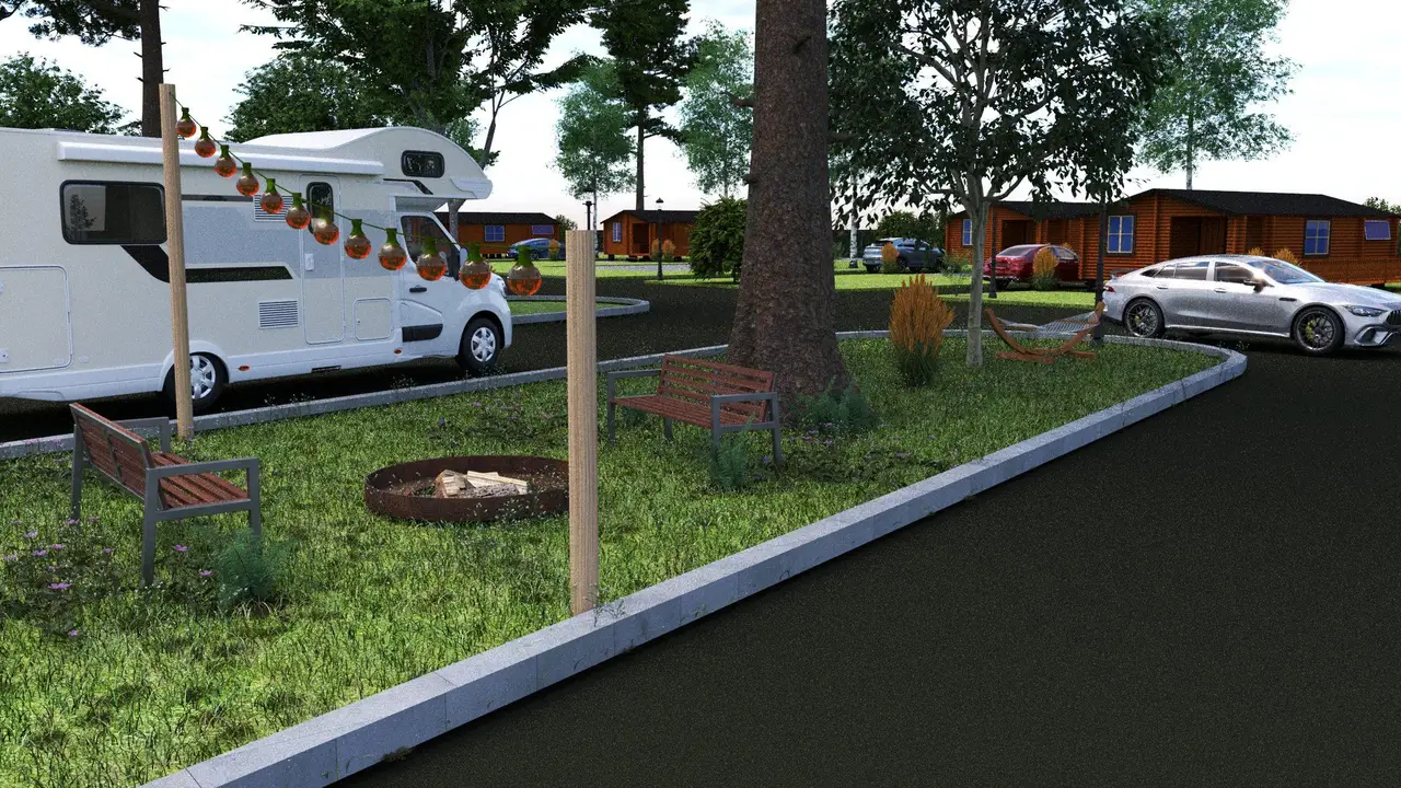
What the studio renders
Innowave Studio is a site planning and 3D visualization studio for real estate developers. It renders exterior, aerial and flyover views tied to the site plan. The model is built from the preliminary site plan the studio draws, so the buildings, pads and sites, internal roads, drive aisles, parking and amenities sit in each view where the plan and its site data table put them. Interior visualization, stand-alone render jobs and conversions are a separate product line, set out on commercial interiors and conversions.
| View | What it is | Where it is used |
|---|---|---|
| Eye-level exterior | One perspective of the building in its context, from a fixed camera at pedestrian height; Santa Barbara requires photo simulations at eye level [6] | Design review, community meetings, retail frontage |
| Dusk exterior | The same camera with a low sun or blue-hour sky and the interior lights on | One hero image per marketing package; entitlement exhibits use daylight |
| Aerial (bird's-eye) | An elevated camera that shows the project in its district | Site selection, investor decks, master plans, lender packages |
| Flyover | An animated aerial camera path around the site and its district | Capital raising, phased master plans, municipal presentations |
| Site plan rendering | The site plan drawn top-down with color, shadows and landscape texture, without perspective | Leasing site plans, entitlement exhibits, broker flyers |
The set follows the decision the images serve. A conditional use hearing turns on buffers, screening and lighting, which the aerial and the night view show. A capital raise or a lease-up turns on arrival, amenities and the whole program. The hearing record for each asset class, and the rendering page for each, close this page.
Built from the site plan, handed to the engineer of record
The views start from the drawing the developer already takes to the county, the lender and the general contractor: the preliminary site plan. The plan fixes the layout, the buildings and the yield; the model places them in three dimensions on the real parcel. The full site plan service is on site plans, and how a project runs is on process.
The engineering layer is not in the plan and not in the renders. Grading and drainage, stormwater, sewer and water lines and electrical design are drawn by the client's engineer of record, who builds the sealed set on the preliminary plan. Technical evidence for a hearing sits in its own study. In Colonie, New York, the planning board asked a car wash applicant for vacuum and mechanical sound data and turning templates, and required elevations and renderings on resubmission [8]. The sound data belongs to an acoustic submission; the rendering shows placement and screening.
The drawings carry the dimensions; the rendering carries the design intent. The Landscape Institute's technical guidance says any two-dimensional visualization "should, therefore, be considered an approximation" (para 1.2.13) [7], which is why boards that need measurement ask for registered simulations and story poles rather than a better picture. The studio and its principal, Viola Sauer, are introduced on about.

What planning and design review boards ask to see
| Body | What the checklist or record asks for | Stage |
|---|---|---|
| San Francisco Planning | Renderings for new construction; photographs always; a consultant shadow analysis for buildings over 40 ft affecting Rec and Park land [9] | Application intake |
| Seattle SDCI, Early Design Guidance | One or more color renderings of massing and concept; street-level views preferred over aerials; massing shown in context, not alone; streetscape photos of both sides; a 3D or axonometric view of the surrounding nine blocks [1] | First design review stage |
| Scottsdale, AZ, Development Review Board | Color elevations (gray copies refused), perspectives, streetscape elevations and physical material boards before the hearing [10] | Submittal and pre-hearing |
| Cleveland, OH, Design Review | Context photos at conceptual; to-scale perspectives or photo simulations at schematic only if the committee requests them; signage, lighting and material samples at final [11] | Staged |
| Sonoma County, CA | Multiple public viewpoints; simulations at completion and at landscape maturity; equal vertical and horizontal scale; registration to baseline-photo control points with field verification; story poles for smaller or near-urban sites [12] | Environmental and visual review |
| San Mateo County, CA, coastal zone | Applicant photo simulations from highway and neighborhood viewpoints, existing versus proposed, used by staff to assess height and position (practice, not a written standard) [13] | Coastal Development Permit review |
| Santa Barbara, CA | Story poles for new nonresidential, mixed-use or multi-unit buildings over 17 feet, certified to +/- six inches; eye-level photo simulations keyed to a location map, with accurate plate and roof heights [6] | Not stated |
| Los Gatos, CA | Simulations that state the lens focal setting or angle of view, locate the photo accurately on a map or aerial photo, and demonstrate dimensional accuracy [14] | Not stated |
In San Francisco, Seattle and Scottsdale a color rendering is close to a baseline exhibit for new construction [9, 1, 10]; Cleveland asks for perspectives only when its committee requests them [11]. Seattle adds the view that carries the most weight: street level, with the neighbors in it [1]. Sonoma County goes further. Its guidelines discourage architectural renderings in visual impact analysis because they tend to soften visual effects, and they ask for registered simulations instead [12]. Story poles are the physical version of the same test: Los Gatos surveyed 22 jurisdictions in 2012 and found 11 requiring story poles or approved alternatives [15].
What lenders ask for
| Lender document | Renderings | What the file runs on |
|---|---|---|
| Self-Help, commercial real estate loan checklist (CDFI) | Listed: site plan, renderings and schematics under Design and Construction [2] | Project description with market analysis [2] |
| Live Oak Bank, construction loan checklist | Not mentioned [3] | Architectural plans and specifications, budget, GC contract, contractor license [3] |
| Provident Bank, construction application checklist | Not mentioned [4] | Description of materials; building permits and approved plans [4] |
A rendering is a lender-specific item, not a standard one. The credit file runs on plans, specifications, budgets and contracts. What a rendering set can do for a lender is match the file: when the views are built from the same site plan the lender reviews, the pads, buildings and parking in the aerial are the ones counted in the site data table. Lenders are one reader among several; boards, brands, buyers and tenants are the others. Two posts cover what lenders read in the plan itself: multifamily site plan anatomy and the construction loan underwriting checklist.
Accuracy and disclosure standards
The Landscape Institute's Technical Guidance Note 06/19 (under review since January 2024) separates two classes of image. Technical visualizations should let the competent authority understand the likely effects of a proposal and must be "accurate, objective and unbiased"; illustrative visualizations are intended for marketing and need not be based on specific viewpoints (paras 1.2.2 to 1.2.3) [7]. The note defines four types, from Type 1 annotated photographs to Type 4 survey- or scale-verifiable photomontages. Type 4 requires a tripod, a panoramic head, a full-frame sensor with a 50 mm lens and best-available survey data [7]. Among US rules, Sonoma County's registration and field-verification requirements come closest to that standard [12].
Federal advertising law judges the image as a whole. Under the FTC's Policy Statement on Deception (1983), an ad is deceptive if a material representation or omission is likely to mislead consumers acting reasonably, judged on "the entire mosaic, rather than each tile separately" [16]. FTC staff's .com Disclosures guidance (2013) states that a disclosure "only qualifies or limits a claim" and "cannot cure a false claim" [17]. A small artist's rendering caption does not protect an image that misstates height, views or amenities.
State rules for regulated offerings give the clearest codified US benchmark for a fair rendering:
| Rule | What it requires |
|---|---|
| California, 10 CCR 2799.1 (subdivision advertising) | Depictions accurately portray proposed improvements as they will be constructed; a non-photographic depiction bears a prominent disclosure such as ARTIST'S CONCEPTION and a legend of improvements not yet in existence [18] |
| New York, 13 NYCRR 22.6(h) (offering-plan advertising) | Marked as an artist's rendering; accurately and realistically depicts the dimensions, height and landscaping of the property and the surrounding roads, buildings and open space [19] |
| New Jersey, N.J.A.C. 5:26-5.2 (planned real estate developments) | A sketch or artist's conception is clearly stated as such, immediately adjacent [20] |
| Minnesota, Rule 2810.1300 | Artists' conceptions are prohibited unless captioned as such and the subject matter is bonded [21] |
| Alaska, 3 AAC 20.160 | An artist's sketch of a proposed improvement indicates that the improvement is proposed [22] |
These rules target regulated residential and land offerings rather than most commercial leasing, but they set out in writing what a fair rendering is. Brokers who market with the images carry their own duty: Article 12 of NAR's 2026 Code of Ethics requires REALTORS to present a true picture in their advertising, marketing and other representations [23].
The professional markers of a fair image are concrete:
- Neighbors stay in the frame, and setbacks and signage are drawn as entitled.
- Planting is shown at a stated maturity, not fully grown on opening day; Santa Barbara's handout shows landscaping at no more than 5 years growth [6].
- The sun matches the site's latitude and orientation at a stated date and time.
- The camera sits at real eye height with verticals corrected; the Landscape Institute uses a 50 mm reference lens on a full-frame sensor for technical views [7].
- Assumptions about anything not yet designed are disclosed with the set.
Deliverable specifications
Specify each deliverable by its use, not by an adjective.
| Item | Specification | Source |
|---|---|---|
| Print board | 300 ppi at final print size, which Adobe calls "the industry standard for producing high-quality prints" | [5] |
| Large-format board viewed from a distance | Lower resolutions can still work well | [5] |
| A3 sheet | About 4,961 x 3,508 px at 300 ppi | [24] |
| Board content (Santa Barbara) | Eye-level viewpoint, a keyed photo-location map, landscaping at no more than 5 years growth, at least one human figure in perspectives | [6] |
| Technical view (LI TGN 06/19) | Camera, focal length, date, time, weather, coordinates and camera height on record; the 100% reference image is 390 x 260 mm on A3, viewed at 542 mm | [7] |
| Video for editing | Apple ProRes .mov or Avid DNx | [25] |
| Video for distribution | H.264 or H.265 MP4 | [25] |
| Compositing master | OpenEXR, which preserves HDR values with no sRGB encoding curve | [25] |
| PNG still | 8-bit, written with an sRGB encoding curve | [25] |
Color for web and screens is sRGB; conversion to CMYK for print belongs to the printer, from a tagged RGB master. Editable source files are a separate question: most buyers need the finished images, while architects and marketing agencies who re-grade or re-letter need layered PSD files or EXR render elements.
Rendering pages by asset
| Asset | Rendering page | Site plan hub | Model project |
|---|---|---|---|
| RV parks and resorts | RV park and resort rendering | RV park site plans | RV resort, Bandera County, Texas |
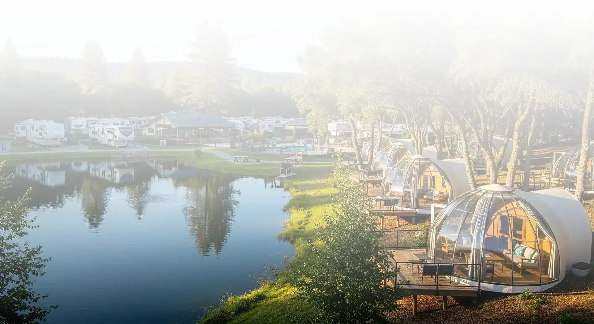
| Glamping | Glamping rendering | Glamping site plans | Glamping resort, Kane County, Utah |
| Car washes | Car wash rendering | Car wash site plans | Express car wash, Mansfield, Texas |
| Hotels | Hotel rendering | Hotel site plans | Select-service hotel, Murfreesboro, Tennessee |
| Apartments | Apartment rendering | Not applicable | Not applicable |
| Flex space and industrial | Flex and industrial rendering | Flex space site plans | Small-bay industrial, Grove City, Ohio |
| Interiors and conversions | Commercial interiors and conversions | Not applicable | Not applicable |
The public record shows what each kind of hearing turns on:
- RV parks. In New Hanover County, North Carolina, neighbors raised noise, light pollution, traffic, safety and trespassing; the developer offered a 50-ft buffer (double the requirement), an 8-ft privacy fence at the entrance and a 30-day stay cap [26]. The aerial shows the buffer; the entry view shows the fence.
- Glamping. A San Bernardino County conditional use permit for a 4-site geodome campground on 2.39 acres in Joshua Tree carried three photoreal renderings (entry and units) and a site plan in the record. Its conditions covered quiet hours, no events, downward lighting with a photometric study and a 50-ft buffer around Joshua trees, and no public comments were received [27].
- Car washes. In Colonie, the planning board asked for stacking on the plan, lower pole heights with down-lighting, non-white fencing and street landscaping, and required elevations and renderings on resubmission [8].
- Hotels. The brand reviews before the city does: PIP submissions include specifications and illustrations of proposed modifications, reviewed by the brand before procurement [28].
- Apartments. Seattle's design review wants color renderings with massing shown in the context of the surrounding nine blocks [1].
For how site plans and visuals work together on a resort, see the role of site plans and visualizations; for the craft of rendering itself, see from models to masterpieces. Model projects in real jurisdictions are collected under case studies. To start, send the parcel or the site plan through the project form.
Frequently asked questions
Do lenders require renderings?
Not as a rule. Self-Help's commercial real estate loan checklist lists site plan, renderings and schematics under Design and Construction [2]. Live Oak Bank's construction loan checklist and Provident Bank's construction application checklist do not mention renderings; they run on plans, specifications, budgets, contracts and permits [3, 4].
What do design review boards ask to see?
San Francisco Planning asks for renderings for new construction and photographs in every case [9]. Seattle's Early Design Guidance packet asks for one or more color renderings of massing and concept, prefers street-level views to aerials and wants massing shown in context [1]. Scottsdale's Development Review Board asks for color elevations and refuses gray copies [10].
Should the set lead with an aerial or an eye-level view?
What is a verified view, and when is it needed?
A view whose camera, lens, date, time and survey control are on record, so that it can be checked. The Landscape Institute's Type 4 photomontage requires a full-frame sensor with a 50 mm lens and best-available survey data [7]. In the US, Sonoma County requires simulations registered to baseline-photo control points, with field verification, for covered projects [12].
Can an AI-generated image go into an approval set?
Does an artist's rendering caption protect an inaccurate image?
Sources
- 1)Early Design Guidance packet requirements, Seattle Department of Construction and Inspections (SDCI). Accessed 2026-10-07.
- 2)Commercial real estate loan checklist, Self-Help. Accessed 2026-10-07.
- 3)Construction loan checklist, Live Oak Bank. Accessed 2026-10-07.
- 4)Construction application checklist, Provident Bank. Accessed 2026-10-07.
- 5)Print resolution for images in Photoshop, Adobe Photoshop Help. Accessed 2026-10-07.
- 6)Visual Aids and Story Poles (planning handout), City of Santa Barbara, CA. Accessed 2026-10-07.
- 7)Visual Representation of Development Proposals, Technical Guidance Note 06/19, Landscape Institute. Accessed 2026-10-07.
- 8)Planning Board minutes, May 5, 2026 (amended), Village of Colonie, NY. Accessed 2026-10-07.
- 9)Intake Checklist, San Francisco Planning. Accessed 2026-10-07.
- 10)Development Review Board (DRB) Development Application Checklist, sample, City of Scottsdale, AZ. Accessed 2026-10-07.
- 11)Design Review Checklist (2023), City of Cleveland, OH. Accessed 2026-10-07.
- 12)Visual Assessment Guidelines, Permit Sonoma, Sonoma County, CA. Accessed 2026-10-07.
- 13)Coastal zone review record with applicant photo simulations (October 6, 2022), San Mateo County, CA. Accessed 2026-10-07.
- 14)Height Pole and Netting Policy for Additions and New Construction, Town of Los Gatos, CA. Accessed 2026-10-07.
- 15)Study Session on Revision to the Story Pole Policy (2012), Town of Los Gatos, CA. Accessed 2026-10-07.
- 16)FTC Policy Statement on Deception (October 14, 1983), appended to Cliffdale Associates, Inc., 103 F.T.C. 110 (1984), Federal Trade Commission. Accessed 2026-10-07.
- 17).com Disclosures, FTC staff guidance (2013), Federal Trade Commission. Accessed 2026-10-07.
- 18)Cal. Code Regs. tit. 10, sec. 2799.1 (subdivision advertising), California Code of Regulations (via Justia). Accessed 2026-10-07.
- 19)N.Y. Comp. Codes R. and Regs. tit. 13, sec. 22.6 (offering-plan advertising), New York Codes, Rules and Regulations (via Justia). Accessed 2026-10-07.
- 20)N.J. Admin. Code 5:26-5.2 (planned real estate developments), New Jersey Administrative Code (via Justia). Accessed 2026-10-07.
- 21)Minnesota Rules, chapter 2810, including Rule 2810.1300, Minnesota Office of the Revisor of Statutes. Accessed 2026-10-07.
- 22)Alaska Admin. Code tit. 3, sec. 20.160, Alaska Administrative Code (via Justia). Accessed 2026-10-07.
- 23)2026 Code of Ethics and Standards of Practice, Article 12, National Association of REALTORS. Accessed 2026-10-07.
- 24)How to print highest quality (community discussion), Adobe Community. Accessed 2026-10-07.
- 25)Cinematic Rendering Export Formats in Unreal Engine, Epic Games, Unreal Engine documentation. Accessed 2026-10-07.
- 26)Neighbors being neighborly: business owner, neighbors compromise on planned RV park, Port City Daily. Accessed 2026-10-07.
- 27)Agenda Item 2, PROJ-2022-00040, Joshua Tree campsite, San Bernardino County Land Use Services. Accessed 2026-10-07.
- 28)You received a hotel property improvement plan. Now what?, Hotel-Online. Accessed 2026-10-07.
- 29)How AI reshaped the render, and what it still can't build (secondary source), Architecture Lab. Accessed 2026-10-07.