The short answer
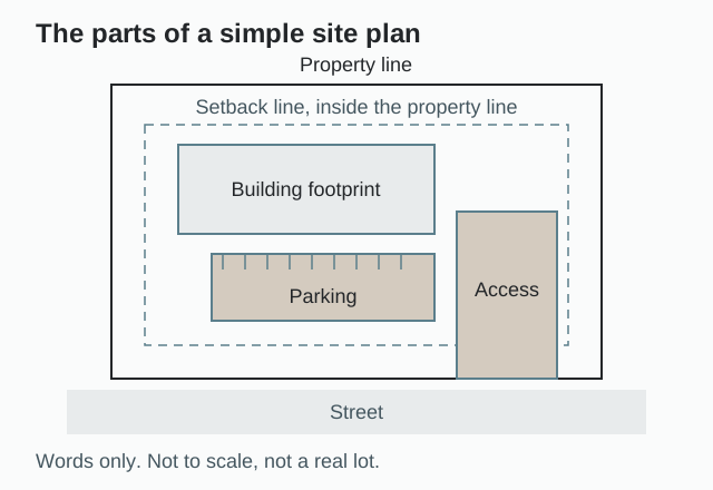
A site plan is a scaled drawing of one property that shows what is on the land and what is proposed for it: the property lines, the buildings, the drives and parking, the landscaping and buffers, and a data table that tests the layout against the zoning code. The Illinois Code Enforcement Manual puts the core in two sentences: "A site plan shows the proposed building location as it relates to the property. It may also show existing and proposed utilities, roadways, topography, drainage and other improvements." [1]
Local checklists turn that definition into a list. Murfreesboro, Tennessee requires a due diligence meeting before a pre-application meeting can be requested, and for it "A dimensioned conceptual site plan is required depicting all proposed and existing structures, vehicle and pedestrian access, parking, landscaping, potential drainage area(s) and a site data table" [2]. At the pre-application meeting that follows, "Plans should be 90-95% complete" [2]. The same site plan is drawn more than once, at rising levels of detail, for different readers.
What a commercial site plan shows
Submittal checklists from four jurisdictions in four states ask for the same core items: the specific use permit site plan in Mansfield, Texas (§ 155.080(D)), the zoning site plan in Gwinnett County, Georgia, the site plan review checklist in Murfreesboro, and the special use permit development plan in Buncombe County, North Carolina (Sec. 78-677(d)) [3, 4, 5, 6]. The table sets each item beside the checklist text that requires it.
| On the sheet | What the checklist asks for | Source |
|---|---|---|
| Property lines | Boundary dimensions, adjacent uses, zoning and streets (Mansfield); external boundaries with dimensions and internal lines (Gwinnett); boundary and proposed lot lines (Buncombe) | [3, 4, 6] |
| Zoning and setbacks | Present, proposed and adjoining zoning and the overlays, with "a table of the required minimum setbacks" (Murfreesboro); setbacks, buffers and landscape strips (Gwinnett) | [5, 4] |
| Buildings | Building location, height, setbacks and entrances (Mansfield); buildings and structures with square footage and proposed and maximum height (Gwinnett); location and use of all structures (Buncombe) | [3, 4, 6] |
| Access and drive aisles | Streets, loading and access, with fire lanes and curb radii (Mansfield); driveways, loading, and street and right-of-way dimensions (Gwinnett); the street system, service and loading areas and access points (Buncombe) | [3, 4, 6] |
| Parking | A parking table (Mansfield); parking with calculations (Gwinnett); "the location of all proposed and required parking and loading areas" (Murfreesboro) | [3, 4, 5] |
| Landscaping and buffers | A landscape plan with chart, and fences, berms and screening (Mansfield); perimeter screens, fences and walls (Buncombe) | [3, 6] |
| Site data | Unit counts, parcel size, densities and open space (Buncombe); lot coverage and floor area ratio (Gwinnett) | [6, 4] |
| Sheet basics | Vicinity map, title block, scale and north arrow (Mansfield); north arrow, vicinity map, legend and scale, with the plan reduced to 8.5 x 11 (Gwinnett) | [3, 4] |
| Service and pedestrian items | Waste and trash facility, sidewalks and pedestrian areas (Mansfield); dumpster locations, sidewalks and trails (Gwinnett) | [3, 4] |
| Elevations, where required | Elevations with materials (Mansfield); color elevations of all sides, including canopies (Gwinnett) | [3, 4] |
Some checklists reach further. Murfreesboro asks for "the location and dimensions of EV Capable, EV Ready, and/or EV installed parking spaces," and Buncombe asks for architectural renderings of commercial buildings in a planned unit development [5, 6]. Gwinnett shows where the zoning-stage plan stops: its pre-application meeting accepts a concept plan uploaded to the county's portal, yet the zoning submittal still needs a registered surveyor's boundary survey and a traffic impact study by a prequalified engineer [4].
The site data table
The site data table is where the layout is checked against the code, line by line. Murfreesboro requires one on the conceptual plan for the due diligence meeting, and its site plan checklist asks for "a table of the required minimum setbacks as per Chart 2 of this article including the footnotes contained therein" [2, 5]. Buncombe County asks the development plan for the ownership, the zoning district, the development schedule and stages, unit counts, parcel size, densities and open space [6]. Gwinnett asks for lot coverage and, in its commercial districts, floor area ratio [4]. Bandera County, Texas asks a rental community's infrastructure development plan for space numbers and space areas to 0.01, with an area table [7].
On a preliminary plan, the table carries the numbers a site decision turns on: acreage, zoning, density against the cap, setbacks, parking required against provided, and the unit mix. Each line pairs the code's requirement with what the layout provides, so a shortfall shows on the sheet before engineering begins.
What the engineer of record adds
A concept or zoning-stage plan fixes the layout. The engineer and surveyor of record add the sealed layers, and the same checklists show where those layers begin.
| Added by the engineer or surveyor of record | Where the requirement sits |
|---|---|
| A sealed metes and bounds description, by a registered land surveyor | Mansfield, § 155.080(D)(3) [3] |
| Topography, watercourses and the FEMA floodplain sheet | Mansfield, § 155.080(D)(4) [3] |
| Existing and proposed water and sewer, with private line sizes | Mansfield, § 155.080(D)(5) [3] |
| Retention or detention areas "with engineered stamped calculations" | Murfreesboro site plan checklist, per City Code § 29.5 [5] |
| Field delineation of streams and wetlands drawn from mapped data: one Gwinnett zoning plan noted that "streams and wetlands have not been verified with a field run delineation" | Gwinnett County, RZC2023-00002 [8] |
| Road plans and profiles, which "shall bear the seal of a Registered Professional Engineer" | Bandera County, App. B 2.0(f) [7] |
| Infrastructure development plan materials, with "original seals and signatures" of the surveyor and engineer who prepared them | Bandera County, App. A 4.1 [7] |
| A sealed lighting plan with a point-by-point footcandle array | Buncombe County, Sec. 78-668(f) [6] |
The professional rules explain why the engineer of record builds the sealed set rather than stamping another hand's drawing. Tennessee bars a registrant from sealing a document that was not prepared by the registrant or under the registrant's responsibility (T.C.A. § 62-2-306) [9]. New Jersey's board rules split a site plan set among the professions: existing boundary and topographic survey information is prepared by a licensed land surveyor (N.J.A.C. 13:40-7.2), while the locations of drives, parking layout, pedestrian circulation and means of ingress and egress may be prepared by "an architect, planner, engineer, or licensed landscape architect" (N.J.A.C. 13:40-7.3) [10]. The preliminary plan is the base the engineer and architect of record build on.
Kinds of site plan, by stage
Codes name the stages differently, but four recur. In the codes below, the seal arrives with the engineering, not with the layout.
| Stage | What the code says | Seal |
|---|---|---|
| Sketch or concept | Bandera County: a sketch plan is "A map showing a potential subdivision of land not required to be drawn with precision" (2.2.27). Chester County, Pennsylvania: a planning commission "does not rule upon sketch plans." Murfreesboro: the "dimensioned conceptual site plan" for the due diligence meeting [7, 11, 2] | Not required at Bandera's sketch stage or Murfreesboro's due diligence meeting [7, 2] |
| Preliminary or zoning plan | O'Fallon, Illinois: a "Preliminary site plan (concept plan)" is "required to depict conceptual development plans for purposes of approval of a planned or special use." New Jersey: preliminary architectural plans and elevations are sufficient, and the board decides within 45 days, or 95 days for more than 10 acres or more than 10 units (N.J.S.A. 40:55D-46). Hillsborough County, Florida: staff required the note "For Concept Purposes Only" removed from a planned development site plan before certification (PD 24-0676) [12, 13, 14] | None on Mansfield's SUP site plan beyond the legal description; Bandera's preliminary plan is "prepared by registered surveyor or engineer" (2.2.20) [3, 7] |
| Final site plan | New Jersey: decided within 45 days of a complete application (N.J.S.A. 40:55D-50). Murfreesboro: Planning Commission approval for "Any development of one or more acres or five thousand square feet of floor area to be located in a nonresidential district" [13, 15] | Drainage calculations stamped in Murfreesboro [5] |
| Construction set | Hillsborough County: Construction Plan review by natural resources, stormwater, site engineering, zoning, utilities, environmental protection and fire reviewers, after Preliminary Site Development review [16] | Sealed: Mansfield's civil and building permit sets, Bandera's road plans and profiles [3, 7] |
The O'Fallon wording is the useful one for a developer: a preliminary site plan is still a concept plan, drawn to win approval of a use, and the engineering follows it. The difference between the two stages is set out in preliminary vs final site plan.
Who uses a site plan, and why
| Reader | What the plan does for them |
|---|---|
| County or city | The basis of review. In New Jersey, approval of a site plan by resolution is a statutory condition for issuing a construction permit (N.J.S.A. 40:55D-37) [13] |
| Developer | The site decision and the capital raise: the site data table shows what the parcel yields under its zoning before money goes into engineering |
| Lender | Part of the financing request: the layout and the yield the loan rests on |
| General contractor | The scope to price |
| Engineer and architect of record | The base for the sealed set |
Many cities and counties accept an unsealed plan at the concept or pre-application stage, which is where a developer's decisions are made: Murfreesboro at its due diligence meeting, Gwinnett County at pre-application, and Mansfield for the specific use permit site plan [2, 4, 3].
Where to go next
A preliminary site plan is the concept and pre-application drawing described on this page: the layout, the buildings, parking and amenities, and the site data table, drawn without the engineering layer for the engineer of record to build on. Site plan services covers the service as a whole, and where unsealed site plans are accepted sets out which stages take a plan without a seal. For the smaller drawing a homeowner files with a building permit, see site plan for a permit and permit site plans.
The checklists above come from model projects that show how each jurisdiction's rules shape a plan: an express car wash in Mansfield, Texas, a gas station and c-store in Gwinnett County, Georgia, a select-service hotel in Murfreesboro, Tennessee, a glamping resort in Buncombe County, North Carolina, an RV resort in Bandera County, Texas and an express car wash in Hillsborough County, Florida. The asset hubs carry the design standards for each use: car wash, gas station, hotel, glamping and RV park site plans.
For the drawings a site plan is most often confused with, see site plan vs plot plan vs survey; for budgets, site plan cost. The state rules cited here are covered on the Illinois, New Jersey and Tennessee pages, and the anatomy of a permit-ready site plan decodes the symbols and callouts on the sheet. To start a plan for your site, contact the studio.
Frequently asked questions
What does a site plan show?
The Illinois Code Enforcement Manual says a site plan "shows the proposed building location as it relates to the property" and may also show "existing and proposed utilities, roadways, topography, drainage and other improvements" [1]. Commercial checklists add zoning and setbacks, parking with calculations, landscaping and screening, and a site data table [3, 4, 5].
Is a site plan the same as a survey?
No. The survey records the boundary and topography that exist; New Jersey reserves existing boundary and topographic survey information to a licensed land surveyor (N.J.A.C. 13:40-7.2) [10]. The site plan draws the proposed layout on that base. In Illinois, a site plan that shows boundary dimensions or bearings is sealed by a land surveyor as well as by the design professional [1].
Does a site plan need a seal?
Not at every stage. Bandera County, Texas does not require a sketch plan to be drawn with precision (2.2.27), Murfreesboro takes a dimensioned conceptual site plan at its due diligence meeting, and Mansfield's SUP site plan has no seal requirement beyond the legal description [7, 2, 3]. Drainage calculations and road plans are sealed by the engineer [5, 7].
Who approves a site plan?
The local government. Murfreesboro's Planning Commission approves any development of one or more acres or five thousand square feet of floor area in a nonresidential district [15]. In New Jersey the planning board hears site plans, and the zoning board of adjustment hears them where a use variance is involved [13].
What is a site data table?
How does a preliminary site plan differ from a final one?
New Jersey shows the split. At preliminary site plan, preliminary architectural plans and elevations are sufficient, and the board decides within 45 days, or 95 days for more than 10 acres or more than 10 units; a final site plan is decided within 45 days of a complete application (N.J.S.A. 40:55D-46, 40:55D-50) [13].
Sources
- 1)Illinois Code Enforcement Manual (Rev. February 2026), Guidelines for Technical Submissions, Illinois Department of Financial and Professional Regulation. Accessed 2026-08-30.
- 2)Current Planning, City of Murfreesboro, Tennessee. Accessed 2026-10-09.
- 3)Mansfield Code § 155.080, Specific Use Permit, City of Mansfield, Texas (American Legal Publishing). Accessed 2026-10-09.
- 4)Procedures and Instructions: Rezoning, CIC, SUP, Gwinnett County, Georgia, Planning and Development. Accessed 2026-10-09.
- 5)Site Plan Review Checklist, Appendix A, Zoning (updated February 12, 2026), City of Murfreesboro, Tennessee. Accessed 2026-10-09.
- 6)Buncombe County Zoning Ordinance, Chapter 78, Buncombe County, North Carolina. Accessed 2026-10-09.
- 7)Bandera County Subdivision and Land Development Regulations (revised August 25, 2022), Bandera County, Texas. Accessed 2026-10-09.
- 8)Case RZC2023-00002, staff report, Gwinnett County, Georgia, Planning and Development. Accessed 2026-10-09.
- 9)Tennessee Code § 62-2-306 (Title 62, Professions, Businesses and Trades), State of Tennessee (via FindLaw). Accessed 2026-10-09.
- 10)N.J.A.C. 13:40-7, Permissible Division of Responsibility in Submission of Site Plans and Major Subdivision Plats, New Jersey State Board of Professional Engineers and Land Surveyors.
- 11)eTools: Sketch Plans, Chester County Planning Commission, Pennsylvania. Accessed 2026-10-07.
- 12)O'Fallon Code § 157.051, Types of Site Plans; When Required, City of O'Fallon, Illinois (American Legal Publishing). Accessed 2026-10-07.
- 13)Municipal Land Use Law, N.J.S.A. 40:55D-37, 40:55D-46 and 40:55D-50, State of New Jersey.
- 14)Rezoning Application PD 24-0676, Zoning Hearing Master staff report, Hillsborough County, Florida. Accessed 2026-10-09.
- 15)Murfreesboro Zoning Ordinance, Appendix A, Section 7, site plan approval (as indexed in Chart 1, 2019 edition), City of Murfreesboro, Tennessee. Accessed 2026-10-09.
- 16)Site Development Process Fees, Hillsborough County, Florida. Accessed 2026-10-09.
How these sources were chosen and when the page is reviewed: how we research.